Salt Lake City, UT
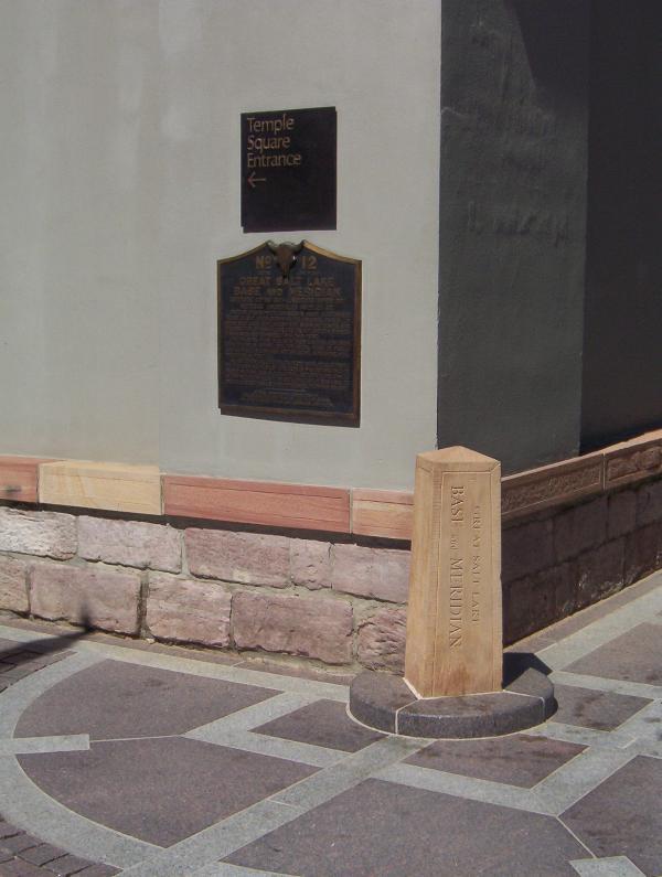
Meridain Marker
GPS Coord: N 40° 46.150 W 111° 53.483
This marker defines the boundaries of Temple Square and serves as the originating point for the city's street numbering system, established by Orson Pratt in August 1847. The stone marker was later set by U.S. surveyor general David Burr. The city plan of wide streets and consistently numbered, uniform blocks was visionary.
Behind the meridian marker, notice the sandstone base to the 13 - foot high adobe wall sorrounding the temple, preserved since 1857. Also on this same corner, notice the bust of Utah's famous pioneer photographer Charles Savage, remebered here as founder of Old Folks' Day.
Showing posts with label Monument. Show all posts
Showing posts with label Monument. Show all posts
Monday, September 19, 2005


Saturday, September 17, 2005
Ensign Peak
 Salt Lake City, UT
Ensign Peak
GPS Coord: ?
Ensign Peak is the summit of a hill just north of downtown Salt Lake City (1.4 miles north of the Salt Lake temple); in fact, Salt Lake City was built exactly south of Ensign Peak. The peak rises 1,080 feet above the valley floor and stands out as a prominent geological formation evident from all directions. The summit is rounded, devoid of vegetation, and capped with a hard conglomerate stone formation. It is part of the foothills of the Wasatch Range.
On 26 July 1847 Brigham Young and several others climbed to the top which he named "Ensign Peak," as he reported the event in his journal. They used the view from the summit to visually explore the entire valley.
The significance of the name, according to the pioneers, comes from the biblical prophecy: "He will lift up an ensign unto the nations. . . . He lifteth up an ensign on the mountains." (Isa 5:26; 18:3). The pioneers did not erect the U.S. flag on the Peak on 26 July as widely reported, but they did plan to fly the "Standard of the Nations," an invitation for all nations to immigrate to Utah.
The locating of the east side of the temple just south of this Peak comes from the statement of George A. Smith who explained that while still in Nauvoo, Illinois, Brigham Young "had a vision of Joseph Smith who showed him the mountain we now call Ensign Peak. . . . and there was an ensign [flag] fell upon that peak, and Joseph said 'build under the point where the colors fall and you will prosper and have peace'." Hence, Temple Square and Salt Lake City were laid out due south of the peak.
From this peak at least one departing Mormon missionary received the temple ceremony. Addison Pratt, about to depart to Hawaii in 1849, was taken to the summit of Ensign Peak and there received the endowment from Brigham Young and several leading elders. Brigham Young said he specially consecrated the Peak for this purpose.
Many organizations in the State have adopted "Ensign" as part of their name, such as: Ensign Stake, Ensign Ward, Ensign Elementary School, Ensign Magazine, among numerous other.
See: B.H. Roberts, Comprehensive History of the Church, (1930); and Lynn M. Hilton, Story of the Salt Lake Stake (1972).
Friday, July 15, 2005
The Nauvoo Bell
Salt Lake City, UT
Nauvoo Bell
GPS Coords: ?
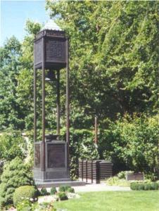
The Nauvoo Bell, weighing over 1,500 pounds, was originally donated by the British Saints for the Nauvoo Temple and brought to the United States by Wilford Woodruff. When pressure from mobs forced the Saints to evacuate the city, the bell was left behind and placed in a local Protestant church. It was recovered by members of the Lamoreaux family before they left Nauvoo to head west.
"One stormy night the men gathered in secret and without horses pulled the wagon to the Church and lowered the Bell, pushed and pulled the wagon by hand to the edge of the Mississippi River and carefully concealed it in the water. Andrew Lamoreaux and his brother, David, were chosen to bring the Bell to Utah with their families, concealing the Bell in their wagon with their provisions."
On the journey to Salt Lake City the bell was used to "awaken the herdsmen at dawn, to signal morning prayer, to start the day’s march, and to sound during the night watches to let the Indians know that the sentry was at his post." Once in Salt Lake City the bell was used in several locations such as the first old bowery, Brigham Young's schoolhouse, a Church business building and the Bureau of Information on Temple Square. It didn't find it's present day location and permanent home until 1942 when the Relief Society placed it in a bell tower on Temple Square to celebrate their centennial.
Placing the bell on Temple Square fulfilled a 1862 prophecy by Brigham Young: "Right west of the temple we shall build a tower and put a bell on it.... This plan was shown to me in a vision when I first came onto the ground." (B. H. Roberts, A Comprehensive History of the Church, 5:136).

In 1961 President David O. McKay, presiding at a ceremony at KSL-TV, said: "In its own way, the Nauvoo bell is a symbol of religious freedom in our land. . . . When we hear, henceforth, the sound of the Nauvoo bell, let it remind us anew that our nation and our community owes its existence to our trust in God." ("As We See It," Church News, July 29, 1961).
Today the bell rings at the beginning of each hour. The ring of the bell on the hour has been featured for years on KSL radio as well to mark the "top of the hour". It is also interesting to note that the ringing of the Nauvoo Bell can be controlled by a panel on the Mormon Tabernacle organ. The bell is also rung on special occassions such as the recent memorial services held on September 14, 2001 for those who died in the terrorist attacks on the United States of America.
Subscribe to:
Posts (Atom)